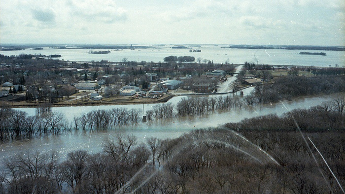
Manitoba Transportation and Infrastructure’s Hydrologic Forecast Centre has issued a flood watch for the Red River from Emerson to the Red River Floodway inlet, just south of the city of Winnipeg. The river is forecast to spill over its banks at some locations with peak flows within the Red River Valley expected to occur between April 8 and 15.
A precipitation system is forecast to bring up to 30 millimetres (mm) of precipitation in most parts of southern Manitoba including the United States portions of the Red River basin and tributaries. This forecast precipitation, together with the gradual snowmelt occurring in the Manitoba portion of the basins, could raise levels above their bank-full capacities at some locations within the Red River Valley.
Water levels are expected to peak between Emerson and the Red River Floodway inlet between April 8 and 15. With the potential operation of the floodway, the level of the Red River in Winnipeg at James Avenue is expected to peak between 17.3 and 18.3 feet (ft.) between April 11 and 16. James Avenue is currently at 15 ft.
The forecast peak flow of Red River at the floodway inlet, with forecast precipitation, is estimated to be between 45,000 and 57,000 cubic feet per second.
Standard operating procedures for the Red River Floodway gates requires river ice to be broken up and cleared upstream of the floodway inlet. River ice observations indicate the ice is likely to clear by the end of the week and could create favorable conditions to operate the floodway if needed. In addition, provincial crews are deployed in a number of communities in the Red River Valley to regularly monitor basin conditions and assess potential dike closures.
Water levels along the Assiniboine, Souris and Pembina rivers are relatively low with no significant flooding issues. The Portage Diversion could be operated to reduce downstream ice-jam impacts. The risk of lakes flooding remains low in most major Manitoba lakes.


