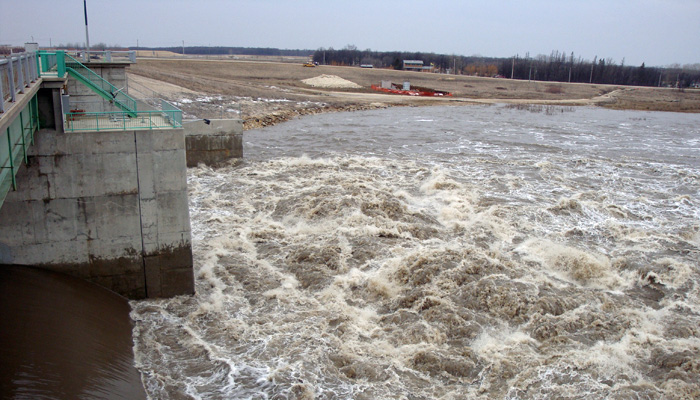
Manitoba Transportation and Infrastructure is preparing to activate the Red River Floodway to manage water levels within Winnipeg in the next 24 to 48 hours after a recent system brought 2 to 10 millimetres (mm) of precipitation to much of the Red River basin.
Forecast precipitation with the gradual snowmelt occurring in the Manitoba portion of the basins could raise levels above their bank-full capacities at some locations within the Red River Valley.
Flows on the lower Assiniboine River are expected to increase to 5,000 cubic feet per second (cfs) in the next 24 to 48 hours and trigger the operation of Portage Diversion to prevent ice jamming on the lower Assiniboine River east of Portage la Prairie and to control river levels in Winnipeg and areas along the Assiniboine River downstream of Portage la Prairie. Portage Diversion gates will be opened today to clear out ice in the diversion channel in preparation for operation.
A flood warning is issued for the Red River from Letellier to Morris and near St. Adolphe. A flood watch remains for the Red River from Emerson to the floodway inlet excepting areas under flood warning. There is a risk of moderate flooding in these areas.
Water levels are expected to peak in the Red River Valley north of Emerson and south of the Red River Floodway inlet between April 6 and 16. With the potential operation of the floodway, the level of the Red River in Winnipeg at James Avenue is expected to peak between 17.4 and 18.4 feet (ft.) between April 10 and 16. James Avenue is currently at 17.4 ft.
The forecast peak flow of the Red River at the floodway inlet with forecast precipitation is estimated to be between 45,000 and 57,000 cfs.
Standard operating procedures for the Red River Floodway gates require river ice to be broken up and cleared upstream of the floodway inlet. River ice observations indicate the ice is likely to clear by the next day or two and could create favourable conditions to operate the floodway. In addition, provincial crews are deployed in a number of communities in the Red River Valley to regularly monitor basin conditions and assess potential dike closures.
Water levels along the Souris and Pembina rivers are relatively low with no significant flooding issues. The risk of lakes flooding remains low in most major Manitoba lakes.
Updated forecast information is available at gov.mb.ca. For current highway conditions and road closures, call 511 or visit manitoba511.ca.


