Manitoba Transportation and Infrastructure’s Hydrologic Forecast Centre is monitoring a potential severe weather system, that began Thursday, could bring 20 to 50 millimetres (mm) of rain to much of southern and central Manitoba over the weekend. The forecast rain will impact flows and levels in most rivers and creeks with the highest impact likely in western and southeast Manitoba.
Thunderstorms and intense rain, up to 60 mm, are possible in the Duck Mountains area and the upper Assiniboine and Qu’Appelle river basins in Saskatchewan and southeastern Manitoba. Some localized areas could receive higher amounts of precipitation. While there is still uncertainty in the weather forecast, there is a band through central Manitoba stretching into the Interlake region that is projected to receive lower amounts of precipitation.
Weather forecasts indicate southern Manitoba will experience strong south to southwest winds starting tomorrow with gusts of up to 90 km/h. There is a high risk of ice pileup on the east shore of Lake Manitoba including areas along Twin Lakes and Lundar beaches. Residents are advised to remain vigilant and to take any necessary precautions.
The strong winds on Friday could also cause water levels in flooded areas of the Red River Valley to rise by up to a foot in some areas. Wave action could also add to the temporary increase in water levels and could result in temporary overtopping of roads. There is a low risk of ice – pileup on major lakes due to the south wind. Flooding continues in the Interlake region, Red River Valley and many other portions of central and southern Manitoba. Residents in these areas are advised to monitor local conditions and take any necessary flood-mitigation actions.
A flood warning is issued for the Winnipeg River from the Ontario border to Lake Winnipeg. Above normal rain and snowmelt since early April in the watershed has created significant inflow into the Winnipeg River system. Lakes and communities along this reach are expected to receive record flows exceeding those experienced in 2014, the previous record inflow. Depending on future rain conditions, levels in some locations could exceed the record 2014 levels. Residents and property owners along this stretch of the river are cautioned for flooding and the potential sustained high water levels in these areas.
Most ditches and waterways are either full or near capacity. Heavy rain occurring over a short period on saturated soil could create overland flooding. An overland flood warning for a portion of southwest Manitoba and the southeast corner of the province remains in effect. The remainder of southern Manitoba remains under a flood watch. An overland flood warning indicates a higher probability of overland flooding occurring based on forecast precipitation, whereas an overland flood watch indicates that overland flooding is possible but not as likely to occur. Water level forecasts will be updated to determine impacts from this precipitation on areas that are already experiencing flooding.
The Assiniboine River basin is forecast to receive up to 30 mm of rain in the next two days. As the result of this rain, flows and levels along the Assiniboine River main stem and tributaries are expected to increase. Generally, levels on most tributaries are expected to rise by one to two feet and slightly more for smaller creeks and streams. The effect of this precipitation may necessitate an increase in the outflow from the Shellmouth reservoir, pending a meeting with stakeholders on the Shellmouth Liaison Committee. The effect of any increased flows will diminish as the river moves downstream and operation of the Portage Diversion will further reduce flows before they reach Headingley and Winnipeg. River users should be cautious. The province will continue to monitor conditions in the upper Assiniboine River as well as downstream river levels.
Flood warnings remain in place for most parts of the Red River north of Emerson (except Winnipeg), Dauphin Lake, the Pembina, Morris and Little Morris rivers, the Shannon and Netley creeks, Fisher and Icelandic rivers, the Assiniboine River from the Shellmouth Dam to Brandon, Birdtail Creek, the Whiteshell lakes area and the Whitemouth and Birch rivers. The Little Saskatchewan and Rolling rivers have been upgraded from flood watch to flood warning. A complete list of flood warnings, watches and high water advisories is available in the daily flood reports found at gov.mb.ca.
Several communities throughout the province continue to be impacted by high water levels. The Manitoba Emergency Measures Organization (EMO) continues to work with all local authorities and emergency management partners to provide guidance and support for response and recovery activities.
Reported impacts to date include loss of road access, flooded properties and damage to infrastructure. Because of these impacts, 28 states of local emergency have been declared. Manitoba EMO continues to work with Indigenous Services Canada (ISC) in supporting ISC-led response measures with First Nation communities.
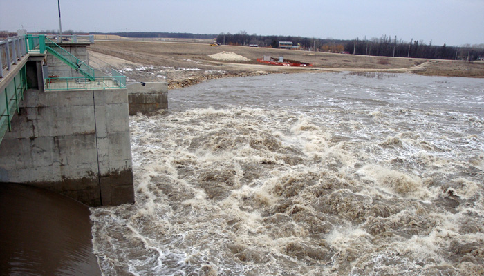
The Red River Floodway and the Portage Diversion continue to operate to lower water levels in Winnipeg. Flows in the floodway channel was near 42,500 cubic feet per second (cfs) this morning. Flows upstream of the floodway inlet this morning are approximately 83,000 cfs.
As fishing season approaches, Manitobans are reminded to stay clear of the Red River Floodway inlet and outlet structures, the Portage Diversion gate structures in the Portage reservoirs and actively flowing spillways on dams. Members of the public are also asked to keep away from flooded areas and areas where flood response crews are working.
Private well owners are reminded to test their wells to determine if they need to take steps to improve water quality and address potentially harmful bacteria. Testing is recommended at least once a year after the spring run-off or after overland flooding.


